Datei:Mediterranean Region map.jpg
Aus Klimawandel

Größe dieser Vorschau: 800 × 378 Pixel. Weitere Auflösung: 2.067 × 976 Pixel.
Originaldatei (2.067 × 976 Pixel, Dateigröße: 434 KB, MIME-Typ: image/jpeg)
Beschreibung
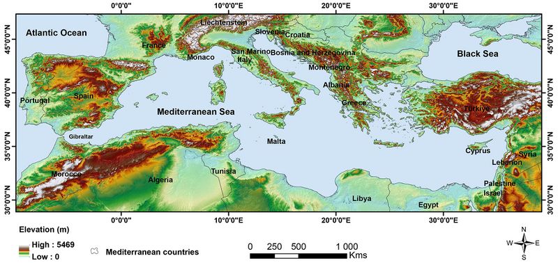
Topographische Karte des Mittelmeerraums
Lizenzhinweis
|
Quelle: Zellou, B., N. El Moçayd, E.H. Bergou (2023): Review article: Towards improved drought prediction in the Mediterranean region – modeling approaches and future directions, Nat. Hazards Earth Syst. Sci., 23, 3543–3583, https://doi.org/10.5194/nhess-23-3543-2023
|
Dateiversionen
Klicke auf einen Zeitpunkt, um diese Version zu laden.
| Version vom | Vorschaubild | Maße | Benutzer | Kommentar | |
|---|---|---|---|---|---|
| aktuell | 12:56, 25. Sep. 2024 | | 2.067 × 976 (434 KB) | Dieter Kasang (Diskussion | Beiträge) | == Beschreibung == Topographische Karte des Mittelmeerraums ==Lizenzhinweis== {| style="border:1px solid #8888aa; background-color:#f7f8ff;padding:5px;font-size:95%;" | Quelle: Zellou, B., N. El Moçayd, E.H. Bergou (2023): Review article: Towards improved drought prediction in the Mediterranean region – modeling approaches and future directions, Nat. Hazards Earth Syst. Sci., 23, 3543–3583, https://doi.org/10.5194/nhess-23-3543-2023 <br> Lizenz: CC BY https://creativecommons.org/licenses/by/… |
Du kannst diese Datei nicht überschreiben.
Dateiverwendung
Die folgenden 2 Seiten verwenden diese Datei:
