Nicht kategorisierte Dateien
Aus Klimawandel
Unten werden bis zu 50 Ergebnisse im Bereich 1.701 bis 1.750 angezeigt.
-
 Klinakliniglacier2018.jpg 800 × 800; 585 KB
-
 Knollensellerie unter AV.jpg 1.252 × 795; 283 KB
-
 Koeppen-Klimazonen.jpg 800 × 400; 165 KB
-
 Kohlenstoff-Quellen-Senken.jpg 901 × 631; 60 KB
-
 Kohlenstoff Emission nach Regionen.png 551 × 402; 26 KB
-
 Kohlenstoffkreislauf OCE.jpg 1.097 × 691; 111 KB
-
 Kohlenstoffspeicher wald holz .jpg 1.696 × 1.200; 392 KB
-
 Kontinente.jpg 599 × 291; 114 KB
-
 Kontinente °C Jahrzehnt.jpg 1.071 × 602; 39 KB
-
 Konvektionsregen.jpg 610 × 436; 40 KB
-
 Konzentration CO2 aktuell.jpg 1.124 × 669; 88 KB
-
 Koppen-Geiger Map Africa.png 1.280 × 758; 244 KB
-
 Korallen ErwärmungsindexDHMI.jpg 739 × 494; 21 KB
-
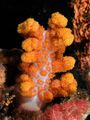
 Korallen Ras Mohammed.jpg 800 × 536; 102 KB
-
 Korallenbleiche1998-2017.jpg 897 × 214; 34 KB
-
 Korallenriff Indonesien.jpg 576 × 768; 156 KB
-
 Korallenriffe.jpg 480 × 240; 101 KB
-
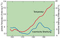 Kosmische strahlung.jpg 534 × 340; 39 KB
-
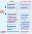 Krankheiten uebersicht.jpg 546 × 574; 241 KB
-
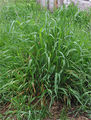 Kriech-Quecke.jpg 180 × 238; 68 KB
-
 Kryosphaere aenderungen.gif 703 × 321; 33 KB
-
 Kyrill Strommast.JPG 800 × 448; 42 KB
-
 KäferSchweiz.gif 678 × 447; 17 KB
-
 Köln Rheinufer Hochwasser.jpg 589 × 599; 70 KB
-
 Küsten-Ökosysteme.jpg 1.606 × 1.606; 327 KB
-
 Küstenlandschaft O-Spanien.jpg 1.025 × 622; 111 KB
-
 KüstenökosystemeWiederherstellung.jpg 429 × 725; 54 KB
-
 LGM-prec-map.jpg 605 × 677; 248 KB
-
 LGM-temp-map.jpg 609 × 673; 218 KB
-
 LGM Ice-Sheets NH.jpg 869 × 863; 92 KB
-
 LGM SST.jpg 801 × 529; 78 KB
-
 LGM Temp.jpg 812 × 538; 75 KB
-
 LGM population fire.jpg 1.040 × 487; 71 KB
-
 LOHAFEX-Region.jpg 491 × 426; 48 KB
-
 La-Nina-impacts-winter.jpg 727 × 367; 67 KB
-
 LaNina WalkerCirculation.jpg 610 × 305; 30 KB
-
 LaNina impacts winter.jpg 901 × 417; 130 KB
-
 La Nina 4.11.2020.jpg 515 × 592; 67 KB
-
 La Nina Atlantic SST 2020.jpg 740 × 458; 219 KB
-
 La Nina El Nino.jpg 685 × 725; 69 KB
-
 Lachgas als GHG1.jpg 490 × 696; 56 KB
-
 Lachgas als GHG2.jpg 488 × 696; 57 KB
-
 Lago-di-Montespluga2013-22.jpg 1.029 × 385; 113 KB
-
 Lago di Montespluga2022.jpg 640 × 480; 91 KB
-
 Lai global rcp85.png 720 × 288; 45 KB
-
 Lai historical.png 720 × 400; 179 KB
-
 Lai map rcp85.png 720 × 400; 153 KB
-
 Land-Use-Effects-on-Climat dt.jpg 962 × 492; 53 KB
-
 Land-Use-Effects-on-Climate.jpg 721 × 333; 126 KB
-
 Land-area exposed drought heat.jpg 1.106 × 569; 208 KB


