Nicht kategorisierte Dateien
Aus Klimawandel
Nachfolgend werden bis zu 50 Ergebnisse im Bereich #1.301 bis #1.350 angezeigt.
-
 Goldkroete.jpg 800 × 534; 76 KB
-
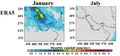 Golf-region-monthly-rain.jpg 809 × 376; 126 KB
-
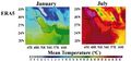 Golf-region-monthly-temp.jpg 801 × 375; 154 KB
-
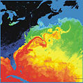 Golfstrom.jpg 363 × 363; 53 KB
-
 Gongga Mountains glacier-area temp1960-2009.jpg 742 × 474; 54 KB
-
 Gorgia streamflow dry wet.gif 624 × 284; 21 KB
-
 Gornergletscher2100.jpg 623 × 438; 245 KB
-
 GrIS-Eisverlust-3,6-°C.jpg 959 × 698; 119 KB
-
 Grace satellites.jpg 800 × 540; 76 KB
-
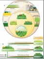 Grass ecosystems anthropocene.jpg 581 × 764; 74 KB
-
 Grass ecosystems global.jpg 1.229 × 622; 135 KB
-
 Grasslands GHG fluxes.jpg 1.200 × 478; 89 KB
-
 Grasslands GHG fluxes dt.jpg 1.067 × 453; 78 KB
-
 Grasslands drivers of change.jpg 1.226 × 703; 133 KB
-
 GreatBarrier bleaching 2017.png 513 × 643; 119 KB
-
 Greece heat wave 2021 stations.jpg 1.789 × 1.134; 441 KB
-
 Green roof Manhattan.jpg 800 × 600; 243 KB
-
 Greenhouse-effect-diagram.jpg 625 × 625; 22 KB
-
 Greenhouse-effect.png 1.024 × 621; 315 KB
-
 Greenhouse-traps-heat.jpg 625 × 563; 19 KB
-
 Greening Sahel 1982-1999.jpg 949 × 365; 64 KB
-
 Greening causes.jpg 2.051 × 754; 186 KB
-
 Greenland MB 1995-2015.jpg 645 × 555; 27 KB
-
 Greenland Melt area12.7.2012.jpg 350 × 680; 94 KB
-
 Greenland SLR 2100.jpg 725 × 472; 102 KB
-
 Greenland SMB D 1972-2018.jpg 726 × 529; 138 KB
-
 Greenland SMB components.jpg 790 × 395; 73 KB
-
 Greenland bedrock.jpg 802 × 1.042; 267 KB
-
 Greenland fire 3.8.2017.jpg 720 × 480; 116 KB
-
 Greenland ice-sheet.jpg 978 × 899; 138 KB
-
 Greenland ice cover.jpg 1.280 × 958; 148 KB
-
 Greenland ice sheet SL2100.jpg 444 × 643; 78 KB
-
 Greenland ocean temp2100.jpg 656 × 529; 184 KB
-
 Greenland speed mass.jpg 577 × 517; 244 KB
-
 Greenland temp 2100.jpg 659 × 524; 235 KB
-
 Grinnell Glacier 1938.jpg 1.140 × 1.475; 322 KB
-
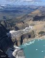 Grinnell Glacier 2019.jpg 1.140 × 1.475; 301 KB
-
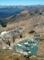 Grinnell glacier1850 1937 1968 1981 2005.jpg 800 × 1.088; 158 KB
-
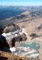 Grinnell glacier 1981.jpg 1.262 × 1.800; 1,28 MB
-
 Groenland.gif 221 × 393; 36 KB
-
 Groenland3000-5000.jpg 428 × 341; 92 KB
-
 Groenland Eem.jpg 341 × 439; 93 KB
-
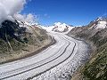 Grosser Aletschgletscher 3196.jpg 480 × 360; 70 KB
-
 Grosswetterlage Hochwasser Europa2013.png 622 × 400; 61 KB
-
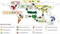
 Große-Grüne-Mauer.jpg 837 × 490; 186 KB
-
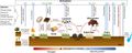
 Grundwasser.png 974 × 520; 68 KB
-
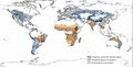
 Grundwasser global.jpg 459 × 303; 115 KB
-
 Grundwasserressourcen Eu.jpg 2.362 × 1.891; 769 KB
-
 Grus grus flocks.jpg 650 × 738; 151 KB
-
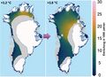
 Grönland Oberflächenänderung2003-2012.jpg 363 × 496; 105 KB


